
Oder basin: flood, low flow, hydrometeorological conditions, water quality

The River Oder originates in the low mountain range Oderské Vrchy (Oder Mountains) in the Czech Republic and flows into the Zalew Szczeciński (Szczecin Lagoon) on Polish territory after 855 km. The international river basin district Oder also includes the entire catchment area of the Szczecin Lagoon, the Świna (Swine) flowing from the lagoon to the Baltic Sea as well as the eastern part of the island Usedom and the west of the island Wolin. The river basin district covers an area of 124 049 sq. km. By far the largest share of this catchment area (86 %) is situated in the Republic of Poland, 6 % in the Czech Republic and 8 % in the Federal Republic of Germany. The majority of the German area within the Oder river basin district belongs to Brandenburg, further shares are in Mecklenburg-Western Pomerania and Saxony.
Significant tributaries of the Oder on the left side are Nysa Kłodzka, Kaczawa, Bóbr and Lausitzer Neisse (Nysa Łużycka) and on the right side Kłodnica, Mała Panew, Bartsch and most notable the Warta (Warthe), which makes up about half of the entire Oder catchment area.
The river course of the Oder is divided into the upper Oder (source to the mouth of the Nysa Kłodzka (Glatzer Neiße)), middle Oder (to the mouth of the Warta (Warthe)) and lower Oder (to the mouth of the Szczecin Lagoon (Zalew Szczeciński)).[1][2]
The Coordinated River Basin Unit Oder and - with the participation of Germany - the following international or bilateral commissions / working groups are committed to water protection and flood risk management of the Oder and its tributaries:
Oder:
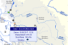
Selection of gauges / water quality monitoring stations
Oder:
Current hydrometeorological conditions
Oder:
Extreme floods / low flows
Oder:
Current water temperature / oxygen content
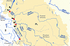
Overview Oder basin
- IKSO: Allgemeine Charakteristik des Odereinzugsgebiets
- [1] IKSO (Koordinator) (2005): Internationale Flussgebietseinheit Oder - Merkmale der Flussgebietseinheit, Überprüfung der Umweltauswirkungen menschlicher Tätigkeiten und wirtschaftliche Analyse der Wassernutzung. - Bericht an die Europäische Kommission [gemäß Art. 15, Abs. 2, 1. Anstrich der Richtlinie 2000/60/EG (A-Bericht)]
- Bundesministerium für Umwelt, Naturschutz und Reaktorsicherheit (Hrsg.) (2000 - 2003): Hydrologischer Atlas von Deutschland (HAD)
- Spiegelberg, K. (2001): Das Oderstromsystem. - Neue odersche Verlags- und Medien GmbH: 1-256, Frankfurt/O.
- WWF-Deutschland/WWF-Auen-Institut (Hrsg.) (2000): Oder-Auen-Atlas
Water quality
- [2] IKSO (2010 / 2015): Bewirtschaftungsplan für die internationale Flussgebietseinheit Oder
- IKSO (Koordinator) (2007): Internationale Flussgebietseinheit Oder - Überwachung des Zustandes der Oberflächengewässer, des Zustandes des Grundwassers und der Schutzgebiete. - Bericht an die Europäische Kommission [gemäß Art. 8 der Richtlinie 2000/60/EG]
- IKSO (Hrsg.) (2000): Stand und Bewertung des Sofortprogramms zum Schutz der Oder gegen Verunreinigung
- IKSO: Geodatenportal: IMS Odra
- Deutsch-polnische Grenzgewässerkommission - Arbeitsgruppe W2: Jahresberichte über die Beschaffenheit der deutsch-polnischen Grenzgewässer
- Umweltministerien der Länder Brandenburg, Mecklenburg-Vorpommern und Sachsen (2015): Aktualisierter Bewirtschaftungsplan nach Artikel 13 der Richtlinie 2000/60/EG bzw. §83 WHG für den deutschen Teil der IFGE Oder. Bewirtschaftungszeitraum 2016 bis 2021
- Landesamt für Umwelt, Brandenburg: Messstationen des Wassergütemessnetzes
- Sächsisches Landesamt für Umwelt, Landwirtschaft und Geologie: Berichte und Bewertungen
- Sächsisches Landesamt für Umwelt, Landwirtschaft und Geologie: Gewässergütedaten (Daten der Vorjahre)
- Sächsisches Landesamt für Umwelt, Landwirtschaft und Geologie: Gewässergütedaten: Datenportal iDA
- Staatliche Betriebsgesellschaft für Umwelt und Landwirtschaft, Sachsen: Das Wassergütemessnetz (WGMN)
- Umweltbundesamt (Hrsg.) (2017a): Gewässer in Deutschland: Zustand und Bewertung
- Umweltbundesamt (Hrsg.) (2017b): Wasserwirtschaft in Deutschland - Grundlagen, Belastungen, Maßnahmen
- Umweltbundesamt (Hrsg.): Geographisches Informationssystem Umwelt (mit Verweisen auf chemisch-physikalische Gewässergütekarten)
- European Environment Agency: Water quality monitoring stations (Karte der Messstellen der Wasserbeschaffenheit (Flüsse [und Kanäle], Seen [und Talsperren], Grundwasser, Übergangs-, Küsten- und Meeresgewässer) für die EU-Berichterstattung)
- European Environment Agency: Waterbase - Rivers (Daten zur Wasserbeschaffenheit der Flüsse in Europa)
Accidental water pollution, warning and alarm plans
- IKSO (Hrsg.) (2015): Havarieplan für die Oder
- IKSO (Hrsg.) (2015): Internationaler Warn- und Alarmplan für die Oder
The Oder in Poland and the Czech Republic
- Poland
- Instytut Meteorologii i Gospodarki Wodnej (Institut für Meteorologie und Wasserwirtschaft): Wasserstandskarte der polnischen Flüsse
- Instytut Meteorologii i Gospodarki Wodnej (Institut für Meteorologie und Wasserwirtschaft): Monitor Pogodynka: Hydrologische Stationen in Polen (Durch Anklicken der Stationen werden die gemessenen Daten der letzten drei Tage angezeigt [Wasserstand / Durchfluss / Wassertemperatur]).
- Krajowy Zarząd Gospodarki Wodnej (Landesamt für Wasserwirtschaft): Informationen zur Umsetzung der EU-Wasserrahmenrichtlinie, EU-Nitratrichtlinie und der EU-Hochwasserrisikomanagement-Richtlinie
- Regionalny Zarząd Gospodarki Wodnej Wrocław (Regionale Wasserwirtschaft Breslau): Wasserstand und Navigationsinformationen
- Regionalny Zarząd Gospodarki Wodnej Poznań (Regionale Wasserwirtschaft Posen): Wasserstand
- Regionalny Zarząd Gospodarki Wodnej Szczecin (Regionale Wasserwirtschaft Stettin): Wasserstand und Wassertemperatur
- Czech Republic
- Povodí Odry, státní podnik: Einzugsgebiet der Oder (Überblick, Aktuelles)
- Povodí Odry, státní podnik: Wasserstand / Durchfluss | Niederschlag | Wasserentnahmen, Einleitungen, Wasserrückhalt
- Ceský hydrometeorologický ústav (Tschechisches Hydrometeorologisches Institut): Hochwasservorhersage; Hydrologische Situation im Überblick | Wasserstand / Durchfluss Odergebiet
Flood / low flow
- IKSO (2015): Hochwasser-Risikomanagementplan für die internationale Flussgebietseinheit Oder
- IKSO (Hrsg.) (2007): Monitoring der Umsetzung des "Aktionsprogramms Hochwasserschutz im Einzugsgebiet der Oder"
- IKSO (Hrsg.) (2005): Anforderungen an Anlagen zum Umgang mit wassergefährdenden Stoffen in Hochwassergebieten oder einstaugefährdeten Bereichen
- IKSO (Hrsg.) (2004): Aktionsprogramm Hochwasserschutz im Einzugsgebiet der Oder
- IKSO (Hrsg.) (2001): Der Hochwassermelde- und Vorhersagedienst im Einzugsgebiet der Oder
- Landensumweltamt Brandenburg (2010): Polderflächen an der Oder
- Ministerium für Landwirtschaft, Umwelt und Klimaschutz des Landes Brandenburg: Gefahren- und Risikokarten
- Sächsisches Landesamt für Umwelt, Landwirtschaft und Geologie: Hochwasserschutz
- Bundesanstalt für Gewässerkunde: Hochwassergefahren und -risikokarten (für alle Bundesländer)
Research projects / programmes
- MONERIS-Projekt: Modellierung von Nährstoffeinträgen aus Punktquellen und verschiedenen diffusen Quellen für die Internationale Flussgebietseinheit Oder für historische, aktuelle und künftige Nährstoffemissionen. Koordinierung: IKSO. Laufzeit: 2012 - 2013
- IKZM-Oder: Forschung für ein Integriertes Küstenzonenmanagement in der Odermündungsregion. Koordinierung: Institut für Ostseeforschung Warnemünde. Förderung: Bundesministerium für Bildung und Forschung, Laufzeit: 2002 - 2010
- Program dla Odry 2006: Programm für die Oder 2006. Nationales Programm zum Hochwasserschutz und zur Förderung der Schifffahrt in der Republik Polen
- BALTEX - The Baltic Sea Experiment (Modellierung von Energie-, Wasserhaushalt, Luft-, Wasserbeschaffenheit und Klimawandel im Ostsee-Einzugsgebiet). Laufzeit: 1993-2012; Nachfolger: Baltic Earth - Earth System Science for the Baltic Sea Region